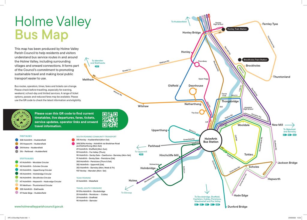
Holme Valley Parish Council has produced a new bus map and guide to help residents and visitors make more use of local public transport.
Whether you’re making a familiar journey or exploring somewhere new, the map brings together routes around the Valley, links between villages and onward connections. The accompanying guide includes QR codes connecting to journey planning, live departures, fares and tickets, accessible and concessionary travel, and rail connections.
The map is available to download from our Sustainable Transport page. Printed copies will also be made available locally soon.
The project forms part of the Council’s commitment to supporting sustainable travel and making local public transport easier to use.
Please check current routes and timetables before travelling, as services can change.