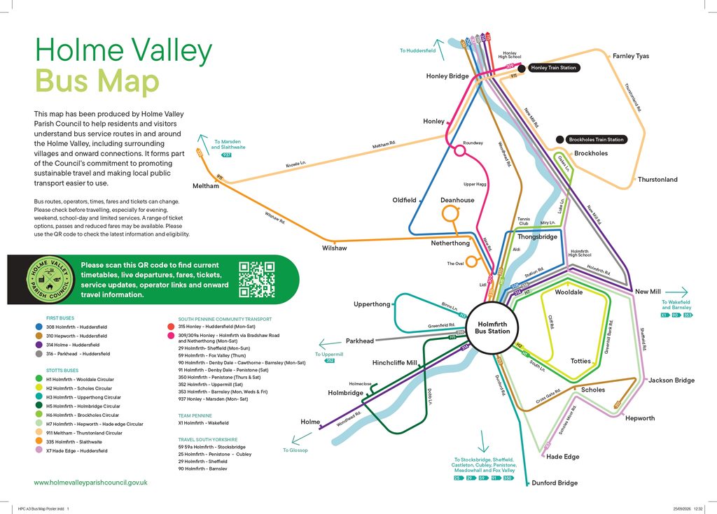
Holme Valley Parish Council makes an annual financial contribution to the Holme Valley (HV) services operated by Stotts buses.
There are National Rail stations at Brockholes and Honley, and scheduled bus services operate throughout the Valley.
Holme Valley Bus Map and Guide
Our bus map and guide helps residents and visitors explore bus routes in and around the Holme Valley, including connections between villages and onward journeys.
Download the folded leaflet for a handy guide with QR codes linking to journey planning, live departures, fares, accessible and concessionary travel, and onward rail and bus connections. A larger poster version of the map is also available.
Downloads:
Published October 2026. Routes, operators and timetables can change, so please check the latest travel information before setting out, particularly for evening, weekend and limited services.